Phoenix-Area Routes
WARNING
Please ride with a front AND rear light that is visible in all conditions. Wear a helmet, wear bright clothing, be alert and obey the rules of the road. Cycling can be a HAZARDOUS activity that has many dangers and risks, including injury or death resulting from accident or physical exertion. Ride safe and look out for one another.
Route: Fountain Hills Loop
https://www.strava.com/routes/2911401655689390670
Difficulty: Moderate
Description: This route starts in N. Phoenix, heads east into N. Scottsdale before winding through the short, punchy climbs of Fountain Hills. As you head north you will encounter rolling terrain past McDowell Mountain Park entering Rio Verde. Next you will encounter "9 Mile Climb" as you head west. This is a long, steady climb that can be difficult when the wind kick up! After the climb, the terrain flattens as you head north on Pima before heading back to start.
Local Tip: Stop for a Snickers in Fountain Hills, you may need it for the climb up 9 Mile...
Route: South Mountain
https://www.strava.com/routes/2920464770330513850
Difficulty: Easy to Hard
Description: This route starts in N. Phoenix, starts in N. Scottsdale and winds through neighborhoods until you reach South Mountain Park. From there, the real begins! Be sure to add on Old San Juan Road if you are feeling good. Traffic will be minimal on the mountain before 10AM on just about every Sunday.
Local Tip: Central Phoenix is home to some pretty amazing coffee spots. Check out Lux Central on your way home.
Route: New River Road
https://www.strava.com/routes/2920465230273163706
Difficulty: Easy - Moderate depending on the wind
Description: This route starts at Apache Wash Trailhead and sends you north through Anthem before hitting one of the best spots in the valley to TT: New River Rd. Get ready for some wind!
Local Tip: Stop at Sweetheart's Donuts in Anthem. You're welcome.
Route: Sonoran Parkway
https://www.strava.com/routes/2735650591898801412
Difficulty: Easy - Moderate
Description: This route is a staple for triathletes as a it's a perfect 16 mile beautifully paved loop. The route has a bit of undulation but not enough to leave the aerobats. You can make this route as short as a long as you like.
Local Tip: Look our for local/international pro's on this route. You never know who you may see out there.
Route: Anthem & New River Hills
https://www.strava.com/routes/2920463369878078906
Difficulty: Easy - Moderate
Description: This route has a bit of everything: flats, long stretches where you can hold speed and even punchy climbs! Be cautious on N.7th street south bound as there is no shoulder for a few miles.
Local Tip: The gas station at I-17 & New River Rd is a great rest stop to refuel.
Route: Carefree Hills
https://www.strava.com/routes/2766847095345421168
Difficulty: Hard
Description: These short, punchy hills keep the vehicular traffic low. But be ready to work and bring your climbing bike. Leave the TT gearing at home for this one. 11/28-30 cassette recommended.
Local Tip: Local Jonny's in Cave Creek has amazing food and coffee.
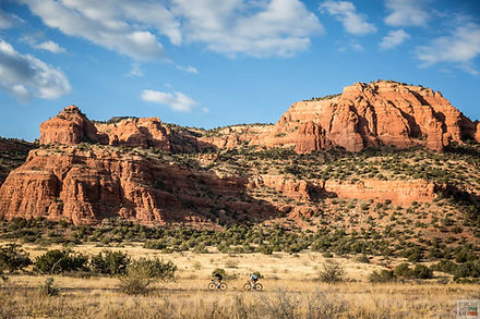
Route: Bartlett Lake & Seven Springs
https://www.strava.com/routes/2920471598194555910
Difficulty: Hard
Description: This route is a staple for Phoenix cyclists. Head north on Pima Road and watch the traffic dissipate as you head into Carefree. In warmer months, you may have boat trailer traffic, so be wise. As you pass the TV towers on your right-hand side you will approach Bartlett Lake Rd. Make a right, stop at the water fountain to top off your bottles and drop down! It's about 13 miles down to the lake. You will encounter some climbs as you descend, so don't think it's a free ride! There is a general store at the lake where you can refuel for the long climb out. After the climb out, refill your bottles and attack Seven Springs for one last push! 11/28-30 cassette recommended.
Local Tip: Stop at Raven's view for a Coke and or snack on the way out of Seven Springs. It's all downhill from there!
Route: Tortilla Flat to End of Pavement
https://www.strava.com/routes/2920464096145494022
Difficulty: Mod - Hard
Description: This route starts at Usery Pass and heads east toward the Superstition Mountains. As you head into the park, be alert & ride single file: there is no shoulder for about 4 miles as you head north before you reach some of the most magical roads in Arizona. 11/28-30 cassette recommended.
Local Tip: Stop at Tortilla Flat for some fuel. You may need it to climb out!
Route: Usery Pass
https://www.strava.com/routes/2920483467824941984
Difficulty: Moderate
Description: This route starts in Tempe and takes Brown Road out to Usery Pass. Going west on Brown Rd you take a left turn on to Usery Pass to head north to a climb and descent. This is a great route for sustained climbing as a 500 ft climb over 4 miles when heading north. After descending and heading back to the south, the climb is 600ft over 4 miles.
Local Tip: There is a gas station at the corner of Brown and Usery for fuel. There is also a water fountain at the Usery Mountain Regional Park Nature Center.
Do you have a route a suggestion or questions? Drop us a line!